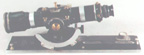
Alidade Plane Table Surveying Instruments
& AG8 North Finding System
©Brooke Clarke,
N6GCE
Photos from eBay with links to the auction
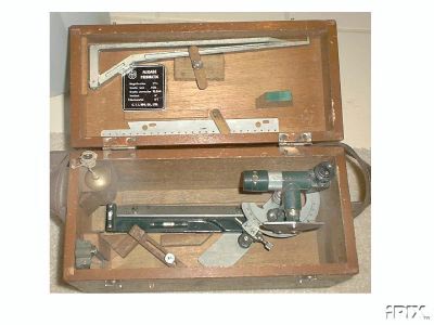
Brass Reproduction Alidades
Marine Alidades
Links
Surveying Patents - moved to
seperate web page
Alidade Patents
Alidade Manuals
AG8 North Finding System
GG3-1 North Gyroscope
Definition
1. An indicator or a sighting apparatus on a plane
table, used in angular measurement.
2. A topographic surveying and mapping instrument used for
determining directions, consisting of a telescope and attached
parts.
There are a number of common usage's, the main subject of this
web page is the map making surveying instrument used on a table
that has been leveled. On ships an Alidade is used to
measure the angle from the ship's longitudinal axis to some
target or targets, typically to help determine the ships
position relative to the target(s). Large telescopes have
an alidade system that's used to point in azimuth.
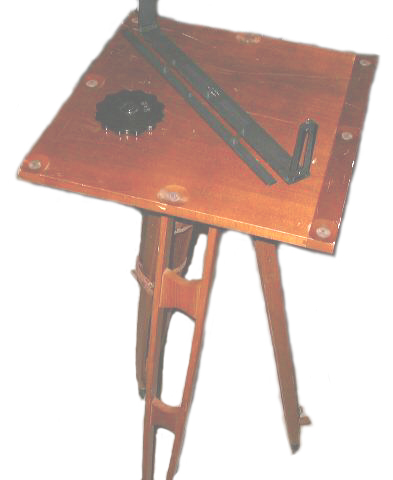
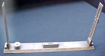
These were used on a wooden table that had a drawing
attached. The idea was to make a map while in the field
using stadia for distance to the rod.
Development
- The very early Alidades were just a ruler with sighting
wires held in a frame at each end. That was what wasused
on the Sketch Boards. See the 1800s Brass and Army units
below.
- A compass can be used as an Alidade when a scale is aligned
with the North position. The Dietzgen Compass with
square scale is in this catagory and you can get a scale base
for some models of the Brunton Com-Pro pocket transits.
- The K&E Early 1800s Alidade appears to be a transit
instrument with a verticle angle measuring vernier capability
and probably with stadia hairs in the scope so that distance
can be manually computed for inclined shots. No compass
as part of the Alidade.
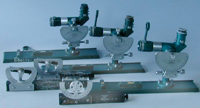
The Berger T-778, Gurley, K&E 5187A, K&E 53491, Lutz,
Ottway Ealing No 92, San appear to be this type.
- The Dietzgen 6220 & 6230 added a stadia computation
scale "Beaman Stadia Arc" to the vernier making it much easier
to compute the distance to the target.
The early Dietzgen seems to also have this capability. TM
5-6675-211-15P for the Dietzgen 6220 & 6230 has change 2
dated 23 May 1973.
- A number of the newer K&E Alidades use an optical scale
like in a theodolite. Optical scales inserase the
accuracy of measured angles as compared to reading a
vernier. The Watts and Wild Alidades may use optical
scales.
- The K&E
76 0000 adds what they call "self
indexing". This is an auto level function where the
optical path is leveled by a pendulum when the bubble is
within the outer ring of the level vial. The reason for
this is to save a huge amount of time when compared to older
systems that need to have the table leveled for each
shot. This means that the table does not need to be
accurately leveled. This can be a problem if the Alidade
is moved after the sight and before a reading.
- Alidades were probably replaced by total stations since
they can determine azimuth, elevation and distance all
automatically, the latest versions work without retro
reflection prisims on most targets.

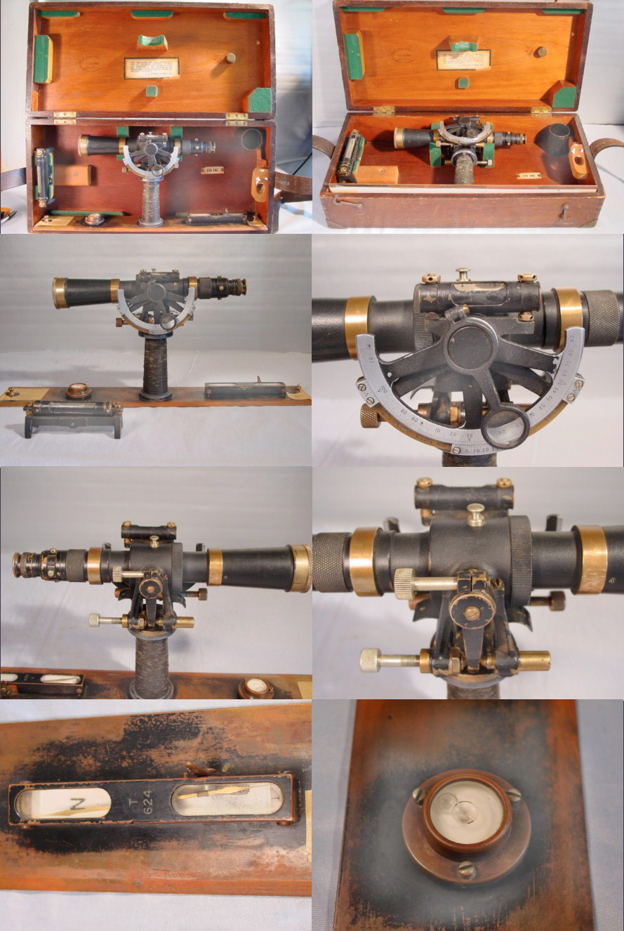
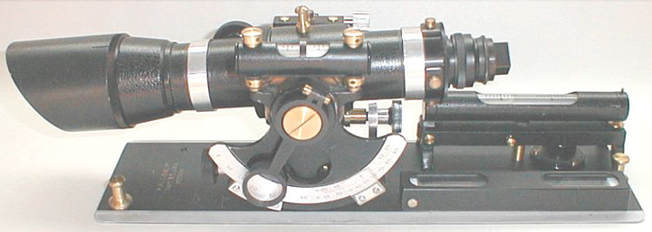
In this close up photo of the K&E 5093A Scale you can see
that when the alidade is level the Lower center vernier will
read 30 degrees, not zero. This is to avoid blunders which
probably were common if level was 0 and there were + and -
numbers on both sides of 0 where a sign error would be a
blunder. Vertical angles from -30 deg to +30 deg can be
read as 0 to 60 deg. That is the limit of vertical angle
measurements, since the rest of the scale is used for the
horizontal and vertical distance factors.
On the left is the "HOR" vernier and on the right the "VERT"
vernier. These are used to convert the slant distance
measured using the stadia method into
horizontal and vertical distances. When the alidade is
level the HOR correction reads 100% and the vertical correction
reads 50% (note you need to subtract 50 from the VERT reading to
get the correction factor that's multiplied times the slant
distance.
Notice that when the alidade is level all three readings are
very much different. Again, I'm sure this is to aviod
blunders.
Links
plane table surveying - is a good search phrase
Article in Point Of Beginning "Plane
Table Mapping" -
Penmap
Digital
Plane
Table -
Instruments
of
Science
and Technology - The
Plane Table -
Doug's
Amateur
Surveying
Page - links to some plane table references
Elements of surveying
and surveying equipment - Ch 11 - Plane Table -
Comparison
of
surveying
techniques -
Surveyor's
Plane Table - offered new for sale in the UK, and a very
simple alidade.
F.W. Breithaupt & Sohn
- Topographical
Instruments -
Surveying
Historical people & dates -
Ebay
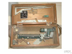
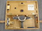
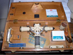
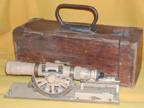
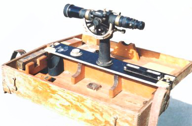
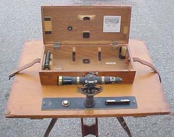
This is a collection of Alidade surveying instruments from
eBay.
1800s Brass
 eBay
-
eBay
-
Army
 eBay
eBay
Berger
T-778
 eBay
reserve not met, relisted eBay
eBay
reserve not met, relisted eBay
1951.C.T.I MFG CO.LTD.
 eBay
eBay
Dietzgen
Might have stadia computation on vernier?
 eBay
eBay
Compass with square scale
 eBay
eBay
 eBay
eBay
6220 (12 to 24 Power) & 6230 (10 to 18 Power)
no photo yet
Gurley
Cat. No. 508 has "H" scale
 .
.  18x24" w/Johnson
tripod head eBay
18x24" w/Johnson
tripod head eBay
 eBay
eBay
 eBay
eBay
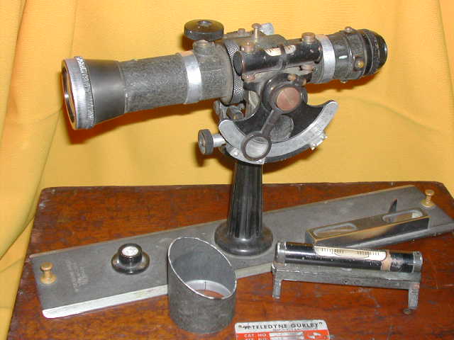
Teledyne Gurley No. 582
 .
.  The has "H" & "V" Scales, eBay
-
The has "H" & "V" Scales, eBay
-
Teledyne Gurley No. 582
 eBay
eBay
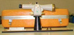
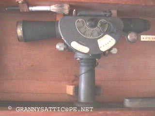
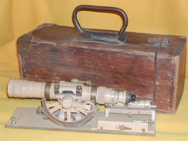
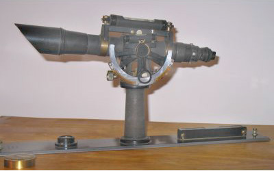
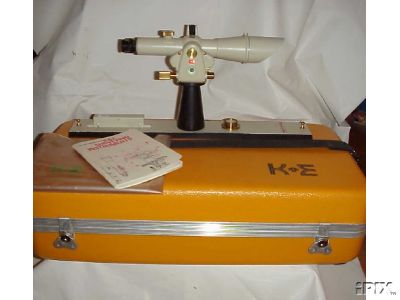
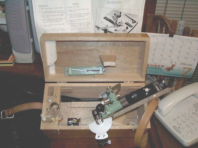
K&E
Alidades
Models with the suffix "SA" have a stadia arc.
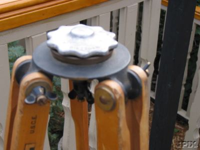
Tripods
Three versions:
5096A - 11 3/4# rigid
5096B - 14 # rigid
5096C - 9# extension legs
Drawing Boards
5096-1 is 15" x 15"
5096-2 is 18" x 18"
5096-3 is 18" x 24"
5096-4 is ?
5096-5 is 24" x 31"
Mk II non optical Alidade
1800 or early 1900s
 eBay
eBay
5187A
 eBay
eBay
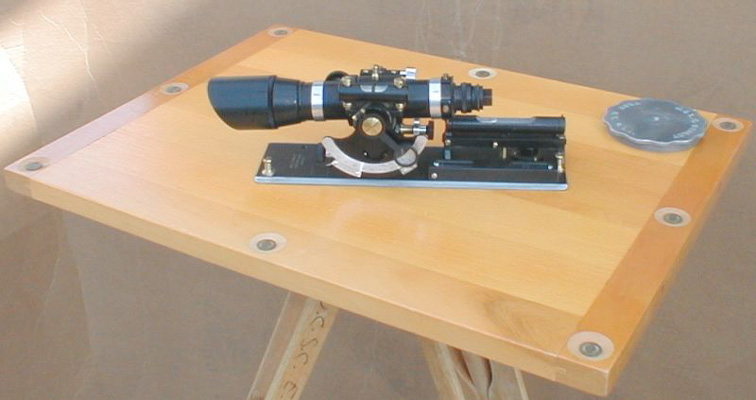
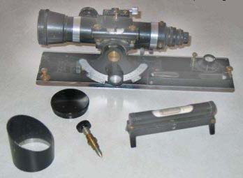
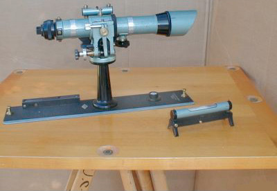
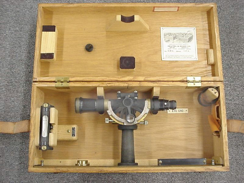
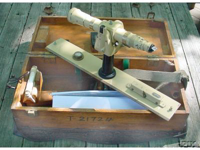
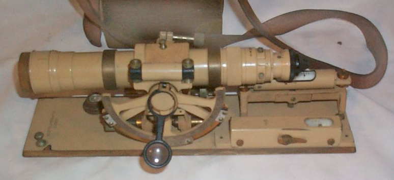
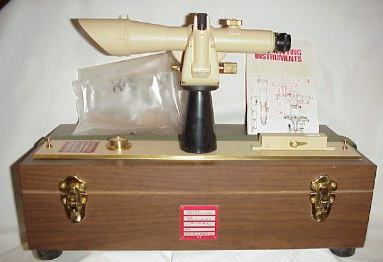
No. 5093A called the Geological Survey Alidade weight 7#
 eBay
eBay
No 5095A called the Expedition Alidade (more compact design),
weight 5 #
 eBay
eBay
63886 1935
 eBay
- photob, photoc, photod, photoe -
eBay
- photob, photoc, photod, photoe -
199892
 eBayeBay
119029 might be a model 76 0030
 eBay
eBay
Military model
 eBay
-
eBay
-
 eBay,
eBay
eBay,
eBay
 Model: 5093A eBay
 Model 53491 eBay
K&E 76-0000
 eBay
eBay
76 0000
 eBay
eBay
1984
 eBay,
another similar by ponejail,
eBay
eBay,
another similar by ponejail,
eBay
Leitz
 eBay
eBay
Lutz EX-3
 Photoa, Photoc, eBay
1917 Ottway Ealing No 92
 eBay
eBay
SAN (Chinese)
 E-3 eBay
looks like a copy of the C.T.I (above)
E-3 eBay
looks like a copy of the C.T.I (above)
MA-5 MOM of Budapest Hungary
 Similar
to the Watts, but not an exact copy or even a completely different
design.
Similar
to the Watts, but not an exact copy or even a completely different
design.
Uses optical scales rather than a mechanical scale and vernier.
Watts
 eBay
eBay
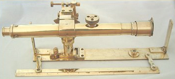
Wild
 eBay Item
729809183 -
eBay Item
729809183 -
Plumbing Arm on Plane Table Case
 eBay
-
eBay
-
Brunton
Has a protractor
that fits onto their 5007 and 5008 Com-Pro
Pocket Transit for map making
Note there are a number of different Brunton pocket transits in
different sizes and mad form different materials.
Also the military versions are have graduations in "mils" not
degrees.
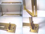
Brass Reproduction
 eBay
- tedamar
eBay
- tedamar
Repro
at Yahoo Shops
Canyon Gold -
Short
Repro
Marine
Atlas
Instruments -
Surveyors
Plane Table -
Links
National Museum of American history - Alidade
- links to a number of instruments and long list a makers &
their history
National
Geodetic Survey - no instrument data
Antique Surveying
Equipment - many instruments for sale:
 Hilger & Watts 6200
 1944 Gurley
 Gurley 580
 Dietzgen 6250
Mapping
with
a Plane Table and Alidade - instructions for use
Photos
of
field
use -
NOAA Photo Library -
drawing
of an 1820 instrument - photo
over
water - 1894
instrument -
Stadia
problem set as pdf document and another worked
example -
Humboldt State University
- Instrument
Collection - Alidade-
Plane table -
diagram of tripod to plane table connection, to accomadate
leveling the table
Traditional
alidade
instruments
combined with a Sokkia SET500 TS -
Plane
table,
alidade,
and wye level - as a set. Mentiones: A metal hinged
plumbing arm to position the pointer and plum bob at any location
on the plane table.
Instruments
of
Science
and Technology - Plane
Table
Alidade. circa 1725 - Plane
Table
Alidade circa 1820 -
Photo
of under
side
of
1840 table and French manuscript
-
Finding the Way and
Fixing the Boundary -
Alidade Patents
These numbers from a Dietzgen Alidade Model 6230:
D98679 Design for a transit support, Adolph
Langsner Eugene
Dietzgen
Company, Feb 25, 1936
D98680 Design for a transit plate, Adolph
Langsner Eugene
Dietzgen
Company, Feb 25, 1936
D98681 Design for a dumpy level, Adolph
Langsner Eugene
Dietzgen
Company, Feb 25, 1936
D98682 Design for a Y level, Adolph
Langsner Eugene
Dietzgen
Company, Feb 25, 1936
2053837 Stadia instrument, Adolph
Langsner Eugene
Dietzgen
Company, Sep 8, 1936, 33/284, D10/66
-
2101077 Spirit level and mounting,
Adolph
Langsner Eugene
Dietzgen
Company, Dec 7, 1937, 33/386 -
2102364 Spirit level and means for mounting same, Langsner
Adolph Dietzgen
Eugene Co, Dec 14, 1937, 33/385
2126195 (Alidale) Sighting device and
support for same, Adolph
Langsner Dietzgen
Co Eugene, Aug 9, 1938, 33/282, 33/333
2126335 Telescope, Langsner
Adolph, Dietzgen
Eugene Co, Aug 9, 1938, 359/513 -
2127302 Level,
Langsner
Adolph Dietzgen
Eugene Co, Aug 16, 1938, 248/181.1
2130095 Telescope, Langsner
Adolph Dietzgen
Eugene Co, Sep 13, 1938, 359/513, 359/426,
359/823 -
2132170 Transit, Langsner
Adolph Dietzgen
Eugene Co, Oct 4, 1938, 33/299, 24/265.00B
-
2132171 (Alidale) Surveying instrument, Langsner
Adolph Dietzgen
Eugene Co, Oct 4, 1938, 33/282 -
2132172 Tangent adjusting means, Langsner
Adolph Dietzgen
Eugene Co, Oct 4, 1938, 33/299, 248/180.1
2171755 Actuating mechanism, Langsner
Adolph Dietzgen
Eugene Co, Sep
5, 1939, 33/349, 33/355.00R -
Manuals
U.S. Army TM 5-6675-211-15P - Dietzgen 6230 (10 to 18
power) & 6220 (12 to 24 power)
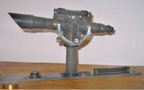
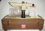
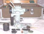
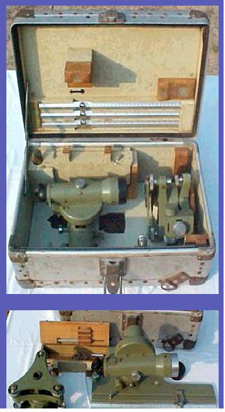
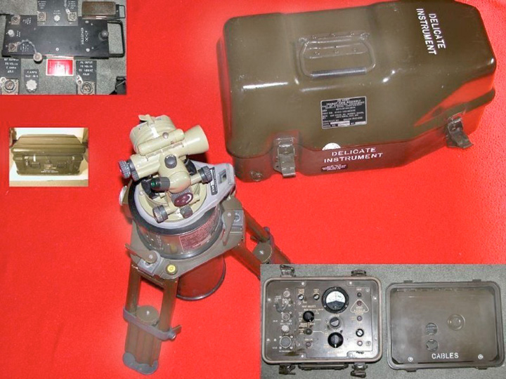
AG8 North Finding System
This is a gyroscope based instrument that finds true
North. Used by the military for artillery and for surveying
in caves where much more accuracy is needed than can be had with a
magnetic compass (or the compass does not work because of the
location).
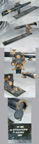
These are parts of a North Finding system, but maybe not the AG8.
ARK2 Gyroscope (or ARK1 or GAK1?)
GKK3 DC - AC Converter
GKB2 Battery
GKL3 Batt. Charger
GST10-2 Tripod
Kern _____ theodolite
GAK1
|
|
|
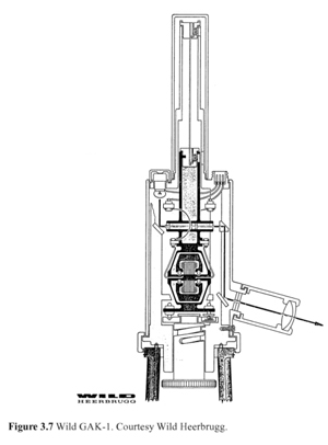
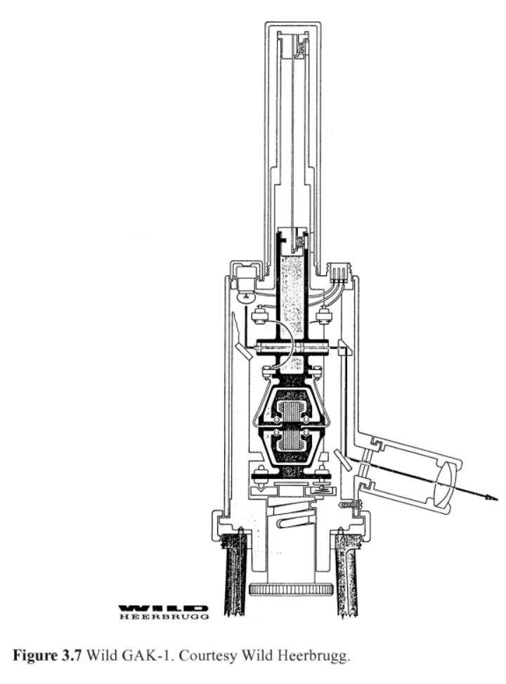
The CERN Applied Geodesy Group developed an
automatic gyroscope, based on the Wild GAK-1,
by replacing the graduated scale by a CCD line of 1024
photodiodes, and the manual adjustment
knob by a motor encoder, to achieve computer-controlled
release of the spinning motor.
(from: Engineering Surveying Technology by T.J.M Kennie,
G. Petrie, ISBN: 0751401935, 0-203-86074-8)
|
|
|
Some of the later PLGR GPS receivers and
all of the DAGR GPS receivers have a
"Gun Laying System" (aka North Finding)
that is as accurate as the AG8, cost much less and can be held
easily in one hand. But will not work inside a tunnel, so
there's still some need for the AG8. The method depends on
carrier phase tracking which is much more accurate than
differential correction.
 eBay
eBay
Kern DKM1
 eBay
not working
eBay
not working
Note that it's possible to use two GPS fixes to determine North
with high accuracy. This can be done using two
interconnected GPS receivers, like the PLGR
or by using a single receiver like the DAGR.
The method may be similar to Differential Corrections, i.e. if the
master GPS location is known (or determined by averaging) then
range and range rate errors for each satellite can be determined
and used to correct the slave GPS receiver. Another method
involves using carrier phase measurements and resolving the
interger errors leading to cm accuracy.
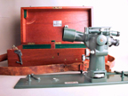
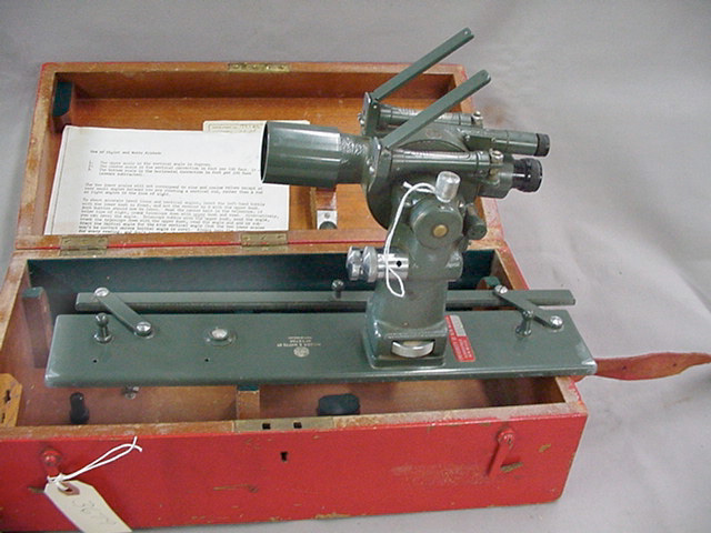
GG3-1 North Gyroscope
NSN: 6675-01-289-8481
Uses the Wild Heerbrugg T16 Theodolite PN 560247. But that
part number does not include the gyroscope.
Links
Spy
Mission
to Montana - CIA mission to locate missle silows using Alidade
and Plane Table as well as a Burton Compass. The compass was
tripod mounted and used to measure bearing angles (not compass
directions) between the power pole at the missle site and some
landmark, like the road.
Back to Brooke's PRC68, Products for Sale,
Surveying, Personal
Home page
This is the [an error occurred while processing this directive] page
created Nov 2002.


