Surveying
© Brooke Clarke 2005 - 2023
Uncle & Grandfather
Stadia
Plot
North Finding
Electronic Levels
HP-48 Graphic Calculator
Earth's Dimensions
Maps
On line Photo Maps
Instruments
Surveying Patents - separate web page
Total Stations
Surveying
Patents
Drafting
Scanned Books & Manuals
My Related Web Pages
References
Links
Uncle & Grandfather
My grandfather on my mother's side was a land grading
contractor. He used horse drawn equipment. His son
(my uncle) was also in the same business but he used modern
heavy equipment. The Huber-Warco grader had hydraulic
controls, most of which had been welded because the "cat
skinners" that he hired were trained on the Caterpillar version
that had mechanical dog clutches and if you didn't hit them hard
you might get a broken wrist. His Euclid bucket (Wiki)
had an engine in front and another engine in the back. His
competition was using CAT scrapers and a bulldozer to push the
scraper. That means his competition had to hire two heavy
equipment operators and my uncle only hired Sid. Both very
modern machines for the early 1960's.
I have my grandfather's
level & tripod. It only has a scope and level
bubble attached to the scope. Not angle readouts.
My uncle had a good "eye for level". He also carried a hand level and a
yard long lath with a notch for the hand level on various
tractors.
Stadia
I use the method called Stadia
to determine both the distance and elevation from the instrument
to the rod.
An <shift><click to download> Excel spreadsheet does the
math. The Example Spreadsheet
has an explanation of how to use it.
I got my own Leitz 115A
transit.
I tried using the Bushnell golfing range
finding binoculars, but they only have 1 yard resolution
and I am trying to get to ideally inches, but practically to
feet of accuracy, so they don't work well.
Stadia is part of Plane Table
mapping using an alidade. See M1913 Sketch Set.
POB magazine - Plane
Table Mapping -
Plot
I use drafting software to plot my boundary and the adjacent
neighbors boundary based on the county recorded maps. This is
for the purpose of doing the landscape design, not for the
boundary. I have found all but one of the survey markers on my
property border. These form the basis for the contour
map. The house is shown, but now I am trying to locate wooden
stakes so that I can then draw the elevation contour lines.
Gyroscopic
A gyroscope will precess
and this can be used to determine true North. It finds use
in underground locations where you can not sight the North star
Polaris or the Sun.
See my Sensors page North
Finding for more on this.
The government version is called the AG8 and is covered in TM
5-6675-250-10
The theodolite is the T16 and is marked:
p/o (part of) GG3-1 North Seeking Gyroscope
NSN 6675-01-289-8481
p/n 560 247
By sighting the Sun or North star you can determine the
direction of true North very accurately. To use this method
you need to know either where the Sun is or know where the North
star is. That is why the Ephemeris data is required.
Without it you can get to within a degree or so, but with it you
can get to seconds of angle.
the Advantages of
Polaris Observations in Land Surveying - Night or DAY
GPS
The later versions of the
PLGR and all the
DAGR
GPS receivers have a North Finding function (the DAGR calls it Gun
Laying System). There are two methods, one uses a single GPS
receiver and the other uses two GPS receivers. They replace
the AG8 in most applications providing the same accuracy for a lot
less money, volume and weight.
Electronic Levels
US5537201:
Electronic leveling system, electronic leveling apparatus and
leveling staff by TOPCON
DL-100 Series Digital Levels - Article in Prof Surveyor - June 99
The rod has a special pattern that can be read by the level.
The height and distance to the rod can be automatically
calculated. The rod may have correction for tilt and
temperature. Topcon does not really tell you what their
equipment can do, maybe all surveyors already know.
HP-48 Graphic Calculator
This calculator has an RS-232 port and some of it's many uses is as
a data collector and doing surveying calculations.
hpcalc.org - HP48 & HP28
Information
Surveying Application
Ramss-
Tripod Data Systems, Inc. -
Chris Nail - some programs
for download
Apex Data Collection Software
- 30 free trial
SMI -
J.S. Sprott
Programs -
HPcalc.org - programs for a
lot of applications
CalcPro - many bugs on new
web pages
Quickclose - Uploadable
and
editable
ASCII HP48 programs -
Earth's Dimensions
Radius (Wiki) :
6,371 kilometers (3,959 mi)
Figure of the Earth (Wiki)
Polar motion (Wiki)
Maps
On line Photo Maps
Microsoft
Terra Server - input a City name and see a composite aerial
photo
Google Maps - allow Lat Lon
input or street address + you can overlay the street map and
photos 1 meter sat photos
and there's a new one that escapes me today, maybe at Microsoft
LAND INFO International -
sold in packages
TIGER Mapping Service - U.S.
Bureau of the Census
Multiresolution
Seamless Image Database (MrSID) - U.S.
Geological Survey Bay Area DOQ Imagery - variable resolution
on line map
USGS - National Mapping
Information - Aerial
Photographs - Digital
Orthophoto Quadrangles - USGS Global Land
Information System -
Microsoft
Terra Server - input a City name and see a composite aerial
photo
Chinese Embassy in Belgrade (NIMA #M903), Marine pilot cuts down
gondola cable, military choppers hit power lines - in all cases
people died because of bad maps by NIMA? or maybe a cover up to
destroy B2 parts in the embassy
USGS - Digital maps,
databases, book-type reports, fact sheets, computer programs, and
other products - Thematic maps are maps that display specific
types of information (themes), such as geologic maps, maps
showing concentrations of particular minerals or elements,
earthquake or landslide hazard maps, etc.
USGS - US
Geo Data - not web viewable - requires Public
Domain Software for use with GeoData -
Map Express Inc. -
Topo Zone - on line 7.5' quad
maps
Instruments
The eBay listings for survey instruments typically have
very wrong titles. Here is what I think these things are:
- Level - has a scope
and bubble level, used to establish level and grade, some may
have a calibrated horizontal circle for bearing.
Most are tripod mounted but some are handheld.
- Alidade
- a scope designed to sit on a table rather than directly on a
tripod. Used to make maps to scale directly in the
field.
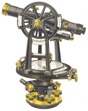 Transit - has both horizontal and vertical scales
that traverse 360 degrees so the scope can be "plunged", i.e.
used upside down thus canceling some common alignment errors
when turning angles. Both the vertical and horizontal
scales have a reference mark that can rotate about it's axis
and a scale that can rotate relative to the reference.
So you can set the scale so it reads zero and then rotate both
of them so that the first target is on the cross hairs.
You then lock the reference. Now unlock the scale and
turn the transit to the second target and after aligning the
cross hair lock the scale. You can now read the
angle. You can now unlock the reference (the scale is
locked to the reference) and turn back to the target and lock
the reference. The scale reading at this point is the
angle between target 1 and target 2. Now unlock the
scale and again turn to and align on target 2 and lock the
scale. Now the scale reads twice the angle between
target 1 and 2. Now plunge the transit, i.e. turn the
scope upside down, release the reference and turn the scope so
it's aimed at target 1 and lock the reference. Now
unlock the scale and turn from 1 and align on 2 and lock the
scale. Unlock the reference and turn back onto 1 and lock the
reference. Now unlock the reference and align on 2 and
lock the scale. The scale now reads 4 times the 1 to 2
angle and you have canceled some of the instrument errors by
turning half the time with the scope normal and half the time
with the scope inverted or plunged.
Transit - has both horizontal and vertical scales
that traverse 360 degrees so the scope can be "plunged", i.e.
used upside down thus canceling some common alignment errors
when turning angles. Both the vertical and horizontal
scales have a reference mark that can rotate about it's axis
and a scale that can rotate relative to the reference.
So you can set the scale so it reads zero and then rotate both
of them so that the first target is on the cross hairs.
You then lock the reference. Now unlock the scale and
turn the transit to the second target and after aligning the
cross hair lock the scale. You can now read the
angle. You can now unlock the reference (the scale is
locked to the reference) and turn back to the target and lock
the reference. The scale reading at this point is the
angle between target 1 and target 2. Now unlock the
scale and again turn to and align on target 2 and lock the
scale. Now the scale reads twice the angle between
target 1 and 2. Now plunge the transit, i.e. turn the
scope upside down, release the reference and turn the scope so
it's aimed at target 1 and lock the reference. Now
unlock the scale and turn from 1 and align on 2 and lock the
scale. Unlock the reference and turn back onto 1 and lock the
reference. Now unlock the reference and align on 2 and
lock the scale. The scale now reads 4 times the 1 to 2
angle and you have canceled some of the instrument errors by
turning half the time with the scope normal and half the time
with the scope inverted or plunged.
By making multiple measurements you can get more accuracy and
precision. Maybe you can only read the vernier to one
minute of arc, but after 3 normal turns and 3 plunged turns
the angle is now calculated to the nearest 10 seconds.
Starting with a 30 second transit and making 6 turns your at 5
seconds, etc. Probably does not do too much good to make
12 turns since other errors probably will show up. If
the overall instrument was that good they would have put a
better vernier on it and sold it for much more money.
- Theodolite
- similar to a transit except instead of using a vernier to
read the horizontal and vertical scales, glass disks and an
optical magnification system are used to achieve much more
precision. Newer models also have a digital display and
output to a data logger.
- EDM - Electronic
Distance Measuring - Uses a pulse of IR light to measure the
distance to a retro reflecting prism very accurately.
- Total Station - combines a theodolite and EDM into a single
instrument with digital output to a data logger. A semi-total station has the
built in EDM and probably has digital readouts, but does NOT
have digital download to a data logger.
- Non Cooperative Total
Station - a total station that does not need prisms.
It can read the distance to most objects directly.
- modern tripods use a 5/8 x 11male thread, older tripods us
a 3½" x 8male thread. Instruments have a female
thread.
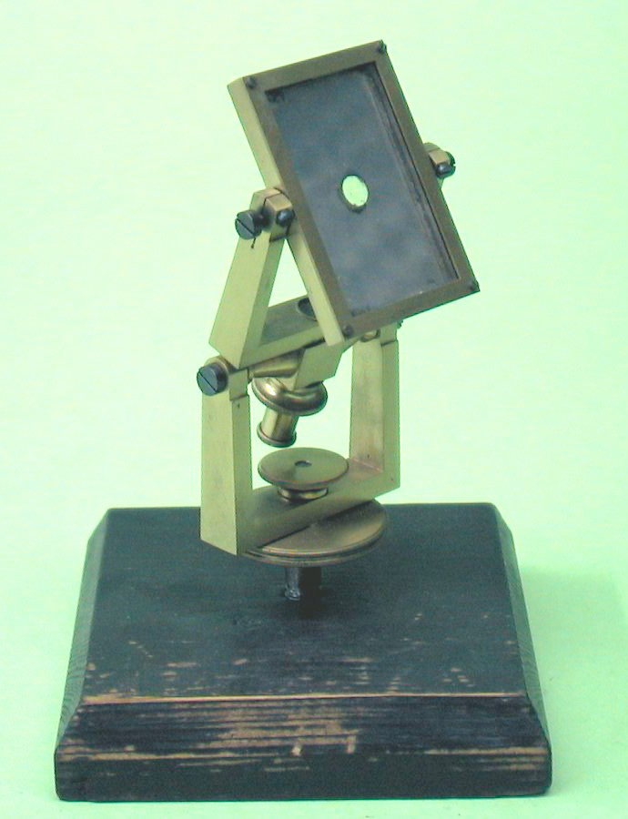
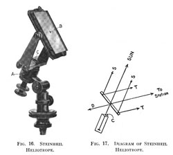
Heliotrope
- Uses mirrors to send the Sun's rays to a far away surveyor so he
can take a reading on the location of the Heliotrope. Photo from Transits of Venus -
another heliotrope

From: Transits
of Venus
|
Illustration from The principles and
Practice of Surveying Vol II
Steinheil Heliotrope
|
The "telescope" on the back does not have an eyepiece, but
instead has some white material that reflects the sun
back. This causes a reflection on the clear glass
center spot and when that image of the sun is pointing to
the target, the sun is reflecting at the target.
This is very similar to the way a survival/rescue mirror
works.
|
On heliographs one way of doing
this is to have both sides of the mirror silvered. Then when
your eye seen the sun's image on your face or clothing centered on
the hole that allowed the sun's light to make the image, you are
looking at where the sun will be reflected at a great
distance. This method is as accurate as the front mirror is
parallel to the rear mirror.
ESSCo Heliostat
A mirror that turns to de-spin the Earth and send the
Sun's light to some fixed point.
Wild T4 Theodolite
My Instruments
- T. F. Randolph Level &
Tripod -
- Leitz 215A
transit (now Sokkia 7327-60), Tripod and extension rod
- K&E 76 0000 Alidade
- K&E Leroy Lettering Set
Most of the lettering on drawings, prior to Computer Aided
Drafting, was done either by hand or using a Leroy lettering
set.
- M1913 Sketch Set -
- M2 Compass and others on Navigation
web page.
Army compass with 0 to 6400 mils instead of 0 to 360
degrees. One mil is 1 yard at 1000 yards to make
artillery spotting easier.
The technical manual is TM 9-1290-333-15. on line at: https://www.logsa.army.mil/etms/data/A/027327.pdf
- this is a secure server that REQUIRES the 128 bit
version of Netscape. The US patent
1,571,697 for this compass was assigned to K&E.
FSN from the TM is 1290-946-8757.
There are a number of "Brass" compasses being offered on eBay
that are imports and come in a number of different sizes, but
all have the appearance of this design.
- Marching Compass
- Range Finders - Stadimeter, Laser,
Optical, etc.
- Theodolites N010C (10C) ,
NT2S, Wild T2, Wild T16
- K & E hand
level made without optics
- O. J. Kuker patent # 1741422
Hand
Level
Dec 21, 1929 356/249
- Field Range Finder by Edumd
Scientific Co.
- Wallace & Tiernan
FA 181 Altimeter - made for topological map surveying
- Abrams Universal Sun
Compass SC-1 -
- Level Vial, Frankford Ordnance Depot, p/n: F209 0431900 dwg:
B173123 May 1952
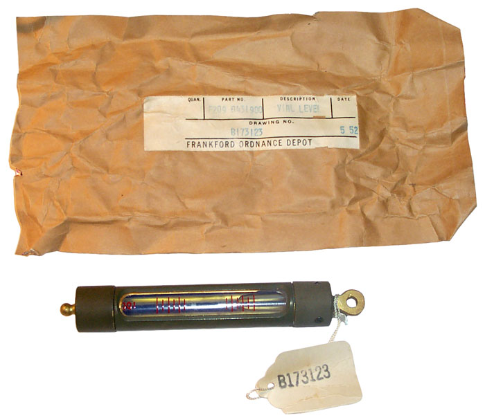
If you know where this level vial
is used please
let me know.
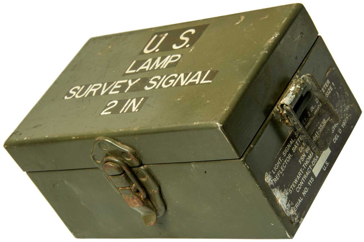
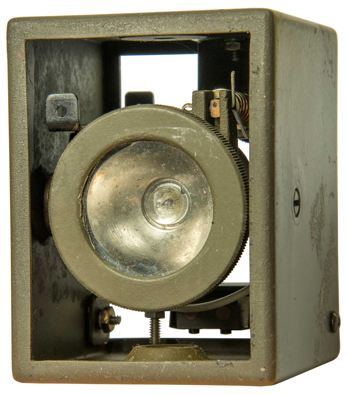
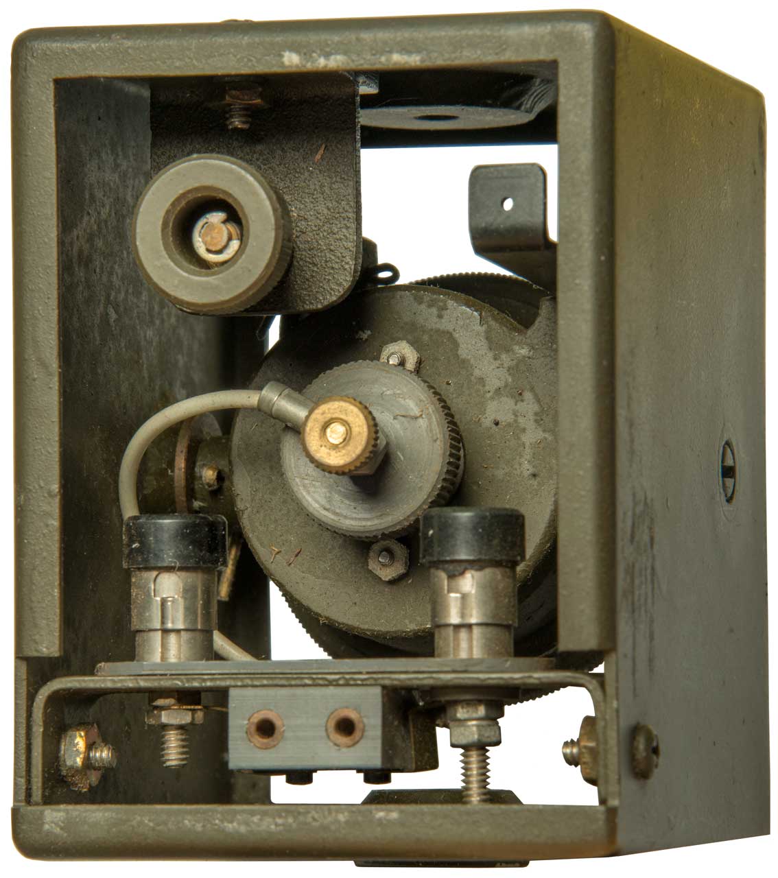
Survey Signal Lamp 2 Inch
Got this after studying the M-132 Signal Lamp. The M-132
is a mystery since it has a lot of features that do not make sense
on a Morse Code signal lamp, but do make sense on a survey
instrument. This Survey Signal Lamp has very similar
features, i.e. a peep sight, up-down tilt mechanism, azimuth
pointing by rotating about the mounting screw (either 1/4-20 or
5/8-11)
Label:
Light, Signal, Survey, 1 In, Diameter
Reflector, Battery pwd., w/case size 1
DL13217E3730
FSN 6675-641-3536 (FSN 6675-641-3569 is for a Wallace &
Tinnerman altimeter)
Stewart-Thomas Industries, Inc.
Contract DSA 700-69-C-G140
Serial No. xxx Del'd 1970
U.S. |
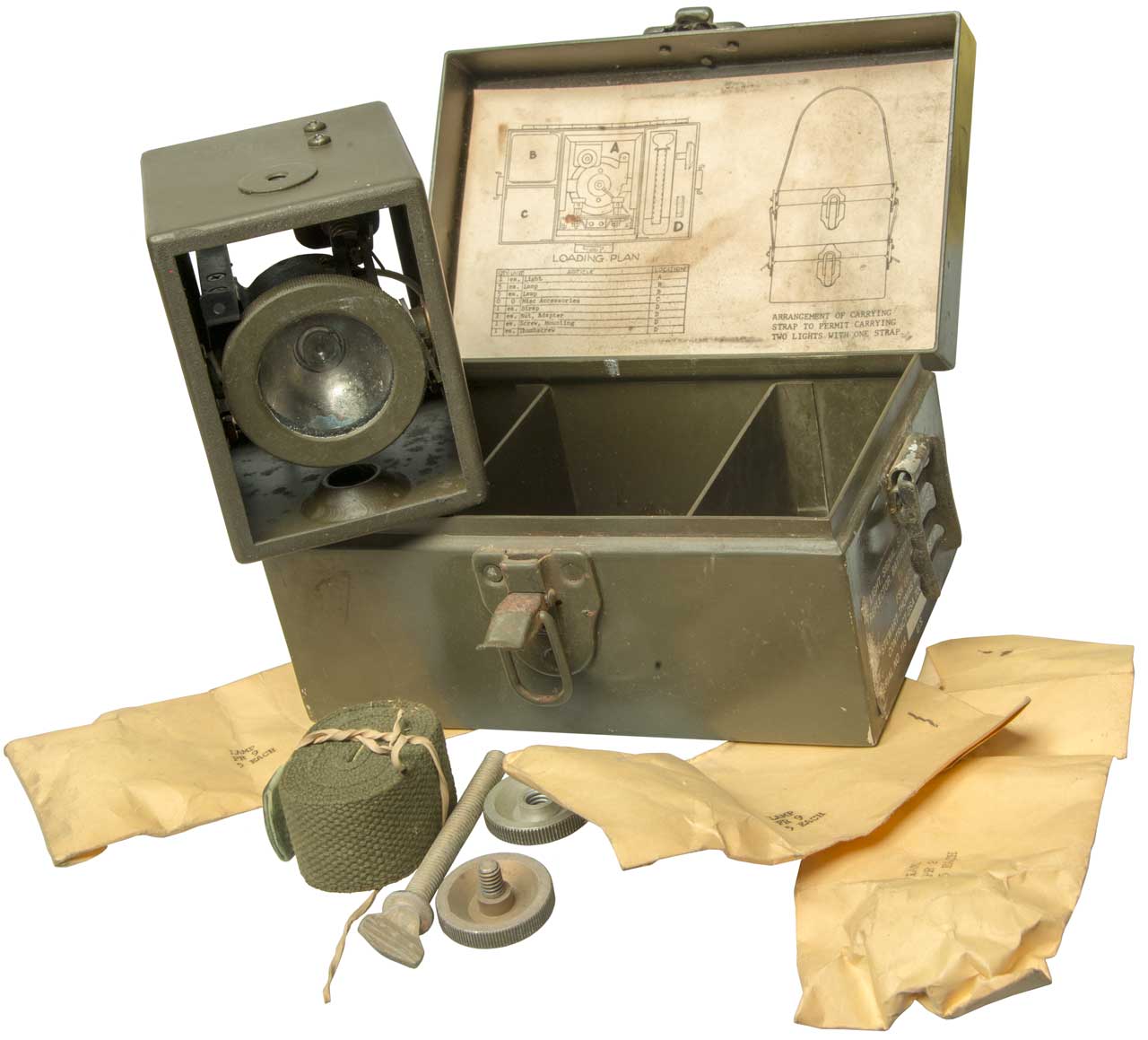
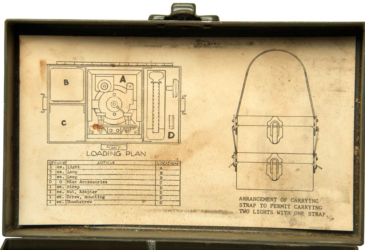
Looks like New Old Stock (NOS). There is no serial number
on the label. The lamp bags contain both PR2 and PR9
Flange type flashlight bulbs. The PR2 is brighter and does
not last as long as the PR9.
PR2: 2.38
Volt - 0.50 Amp - B-3-1/2 Single Contact Miniature Flanged
Base (P13.5S) - C-2R Filament Design - 0.80 MSCP. - 15 Average
Rated Hours - 1.25" Maximum Overall Length - 0.45" Maximum
Overall Diameter - Typically found in flashlights using two
"D" cell batteries.
PR9: Standard replacement
flashlight bulb - 2.70 Volt - 0.15 Amp - B-3-1/2 Single
Contact Miniature Flanged Base (P13.5S) - C-2R Filament Design
- 0.25 MSCP. - 45 Average Rated Hours - 1.25" Maximum Overall
Length - 0.45" Maximum Overall Diameter - Typically found in
flashlights using two "D" cell batteries.
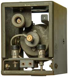
Power can be supplies via field wire
using the push down terminals or by a cord with phone tips.
There is a knob on the back that tilts the lamp head up or
down. Azimuth aiming by rotating about the mounting
screw.
It occured to me that this would be an excellent way to mount
the RA-2 GPS antenna using the magnetic feet on the
antenna. This is because the Signal Lamp has both 1/4-20
and 5/8-11 threads. BUT . . . the sheet metal is
aluminum so it does not work.
Fig 1

|
Fig 2
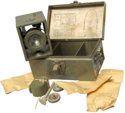 |
Fig 3
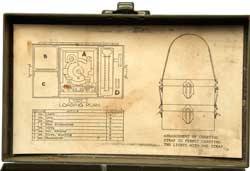 |
Fig 4
 |
Fig 5
 |
|
Drafting
In high school I took all the drafting classes that were
offered. Later that became important since it was a
prerequisit to taking a Physics class at Foothill College that
allowed me to get an AA degree in 1962, then a BSEE in 1964 and
MSEE in 1965. Without the drafting class those dates would
have moved back a semester or year.
Polar Planimeter
The Planimeter (Wiki) is a
drafting tool used to measure an area by tracing out it's
outline. The early models are analog computers.
2768785
Planimeter, Ernest
W Silvertooth, Librascope
, 1956-10-30, -
Scanned Books & Manuals
I have scanned a number of books and
manuals relating to surveying instruments see:
Total Stations
Pentax -
total stations, etc.
Leica - total
stations, etc.
Sokkia - total stations, etc.
Cyra - 3D laser scanner
$155,000
Nikon
- total stations, etc.
Spectra Precision -
total stations, etc.
Topcon - total
stations, etc.
Trimble - GPS but
also total stations
My Related Web Pages
References
Ref 1. YouTube: How do
trig points actually work?, 15:03 -
1. Error caused by thickness of metal strap inserted
into trig pillar side plate.
2. Error when using mag compass to take bearing since no
declination correction. Much better to measure angles T1
to Tn and T2 to Tn.
Links
Allen Precision Equipment
- dealer in surveying supplies -
Anderson Instrument & Supply Co. - manuals -
http://www.andersoninstruments.com
Berntsen Survey Markers -
Chicago Steel Tape (CST) -
equipment manufacturer - good prices - Berger DGT-20 Transit - very
reasonable price
Collection of Scientific
Objects - Photos -
ContractorsTools.com
- carries CST/Berger DGT20
Department of Natural
Resources and Environment in Victoria, Australia - Geodesy in Victoria - Cadastral
Surveying -
Engineering Equipment
-
The
Dividing Engine in History -
EM
1110-1-1003 - Engineering and Design - NAVSTAR Global
Positioning System Surveying
FM
6-2 Tactics, Techniques, and Procedures for FIELD ARTILLERY SURVEY
- Army Field Manual
LO Ink Specialties - Hard
to Find stuff
NGS - GEOID99 -
POB -Point Of Beginning -
magazine
Professional Surveyor -
magazine with good articles and advertizers & annual "Source
Book"
rpls.com - resource including
classified ads
Servco - old and new Leica/Wild equipment -
http://www.servco1.com/
SECO - hand levels &
supplies
SubSurface Instruments , Inc.
- Magnetic, pipe leak, cable
Tripod Data Systems - now -> Spectra Precision
Univ. of Portsmith dept
of Civil Eng - Surveying
- all kinds of stuff
[an error occurred while processing this directive] This is the time
this page has been accessed since 23 Jan. 2000.